
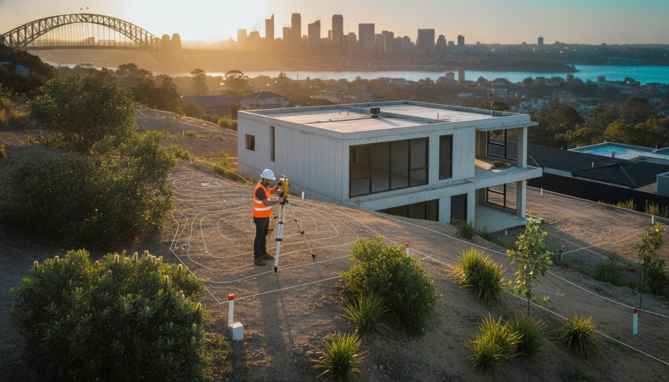
The cheapest line item on your pre-construction budget could end up costing you the most. That’s the quiet reality facing Sydney property owners who treat a detail and level survey as an afterthought rather than a foundation. When your architect is working from inaccurate site data, design errors don’t announce themselves early. They surface during council assessment, in a CDC rejection, or worse, mid-construction when changes are expensive and timelines are unforgiving.
You already sense that something this important deserves careful consideration, and you’re right to want clarity before you commit. The cost of a detail and level survey in Sydney is one of the most common questions property owners bring to their first project conversation, and the variation in quotes can feel genuinely confusing without context to frame it.
This guide is here to change that. You’ll walk away with a clear understanding of what drives survey pricing, which site factors influence the scope of work, and how a precise survey from a Registered Surveyor protects your entire project budget from the kind of errors that derail even well-planned developments. Consider this your grounded, no-surprises starting point.
Key Takeaways
- Understanding the cost of a detail and level survey in Sydney requires context — site complexity, vegetation, and slope all influence pricing in ways a flat quote alone won’t reveal.
- Only a Registered Surveyor in NSW can legally define property boundaries, making their involvement essential for any DA or CDC submission that will withstand council scrutiny.
- Small preparation steps — like clearing overgrowth and gathering existing title documents — can meaningfully reduce your surveyor’s on-site time and keep costs in check.
- An accurate detail and level survey is the first line of defence against mid-construction design errors, which consistently cost far more to fix than the survey itself.
- With over 90 years of experience supporting Sydney architects and developers, Hill & Blume brings a depth of local knowledge that directly reduces the risk of costly project delays.
What is a Detail and Level Survey and Why is it Essential?
Think of it as the difference between designing a home and designing your home, on your land, with all its specific contours, constraints, and opportunities accounted for. The practice of land surveying has evolved over centuries precisely because accurate spatial data is irreplaceable when human decisions, legal obligations, and significant financial investment converge on a single piece of ground.
The Anatomy of a Professional Site Survey
A professional detail and level survey captures far more than simple contour lines. The deliverable your architect receives will typically include:
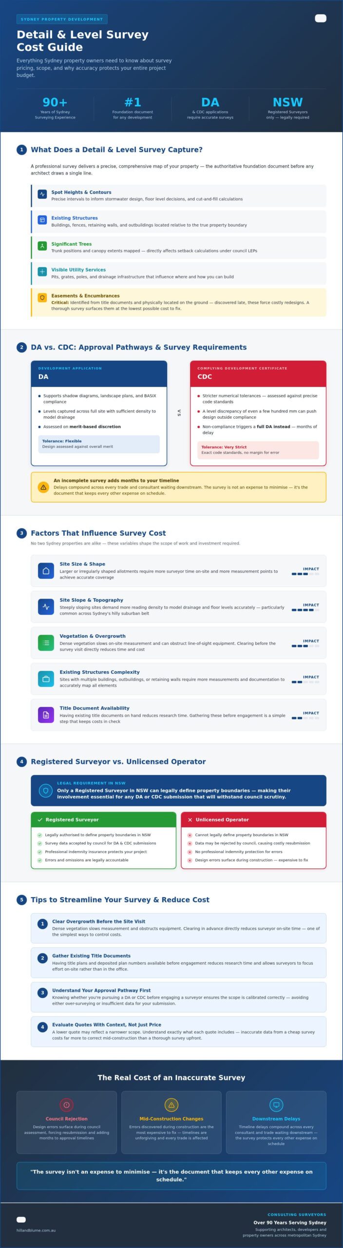
- Spot heights and contours at intervals precise enough to inform stormwater design, floor level decisions, and cut-and-fill calculations
- Location of existing structures including buildings, fences, retaining walls, and outbuildings relative to the true property boundary
- Significant trees mapped with trunk positions and canopy extents, which directly affect setback calculations under many council LEPs
- Visible utility services including pits, grates, poles, and drainage infrastructure that influence where and how you can build
- Easements and encumbrances identified from title documents and physically located on the ground, so your designer knows exactly where constraints sit before a concept is formed
That last point deserves emphasis. Easements discovered late in the design process, or worse, during a council assessment, can force costly redesigns. A thorough survey surfaces these constraints at the moment when addressing them costs the least.
DA vs. CDC: Survey Requirements in NSW
Not all approval pathways demand the same level of detail, but both demand accuracy. A Development Application typically requires survey data that supports shadow diagrams, landscape plans, and BASIX compliance, meaning your surveyor must capture levels across the full site with sufficient density to model drainage and finished floor levels convincingly. A Complying Development Certificate operates under stricter numerical tolerances because it’s assessed against precise code standards rather than merit-based discretion; a level discrepancy of even a few hundred millimetres can push a design outside compliance and trigger a full DA instead.
An incomplete survey submitted with either application type can add months to your approval timeline, a delay that compounds across every other trade and consultant waiting downstream. When you’re weighing the cost of a detail and level survey in Sydney against your broader budget, that context matters considerably. The survey isn’t an expense to minimise; it’s the document that keeps every other expense on schedule.
Understanding what drives the cost of a detail and level survey in Sydney starts here, with understanding what a thorough survey actually contains. The scope of work your site demands is the first variable that shapes the investment, and it’s one worth understanding clearly before you request a quote. Explore the full range of surveying services Hill & Blume provides to see how each component fits your project’s specific needs.
Factors Influencing the Cost of a Detail and Level Survey in Sydney
No two Sydney properties are alike, and no two surveys should be priced as though they are. The cost of a detail and level survey in Sydney shifts considerably depending on what your site presents to the surveyor on the day they arrive. Understanding these variables isn’t just useful for budgeting; it helps you evaluate competing quotes with genuine discernment rather than simply choosing the lowest number.
Several core factors consistently shape the scope of work and, by extension, the investment required:
- Site topography: Sloping blocks demand more spot heights, more instrument setups, and more time to capture accurate contour data than a flat suburban lot in, say, Parramatta or Ryde.
- Property size: Larger parcels require more traversing, more control points, and longer field time regardless of terrain.
- Existing structures: Each building, retaining wall, outbuilding, and fence line must be located and measured. A site with multiple structures takes proportionally longer to document than a cleared block.
- Boundary identification: If your title documents don’t clearly establish where your boundaries sit on the ground, a Boundary Identification Survey may need to accompany the detail plan. This is a separate scope of work with its own field and office components, and it’s governed by strict professional obligations under the registered surveyor licensing requirements in NSW.
- Urgency and location: High-demand suburbs and tight turnaround requests can influence scheduling and resourcing, particularly across Greater Sydney where project pipelines are consistently active.
Topography and Terrain Challenges
Steep blocks in areas like the Northern Beaches, the Hills District, or the Upper North Shore require significantly more field time than their flat-block counterparts. Rocky outcrops force repeated instrument repositioning. Narrow side passages and split-level sites limit where equipment can be set up, which compounds the number of setups needed to achieve full coverage. “Difficult access” isn’t a vague excuse for a higher quote; it’s a measurable increase in the hours required to do the job properly.
Vegetation and Site Visibility
Dense vegetation creates two distinct challenges. First, individual trees must be located, measured, and documented for council canopy assessments under many local LEPs, which is time-consuming work on bushy or established properties. Second, heavy scrub and overgrowth disrupt line-of-sight for total stations, forcing surveyors to establish additional control points to maintain measurement accuracy across the site. On large or heavily vegetated properties, drone surveying can reduce field time meaningfully by capturing aerial data where ground-based instruments would otherwise struggle.
Each of these factors compounds. A sloping, heavily vegetated property with multiple structures and unclear boundaries represents a genuinely complex survey scope, and the quote should reflect that reality honestly. If you’re unsure how your site’s characteristics will affect the scope of your survey, speaking with Hill & Blume’s team early can help you understand exactly what your project requires before you commit to a budget figure.
The Value Difference: Registered Surveyors vs. Unlicensed Operators
Not every person who arrives at your property with a measuring instrument is legally qualified to tell you where your land begins and ends. That distinction matters enormously, and it’s one that property owners often discover too late. In NSW, only a Registered Surveyor holds the legal authority to define, mark, and certify property boundaries. The survey document they sign carries statutory weight that no unlicensed operator can replicate, regardless of the equipment they use or the price they offer.
Unlicensed “site measurers” can capture physical features and produce drawings that look professional. What they cannot do is make any legally defensible determination about where your boundary sits on the ground. If their data informs your architect’s design and that design is later found to encroach on a neighbour’s land or a council reserve, the consequences fall entirely on you. No professional indemnity insurance backs their work. No regulatory body holds them accountable. The cost of a detail and level survey in Sydney from an unregistered operator isn’t a saving; it’s a deferred liability.
Professional Indemnity Insurance is the quiet safety net behind every survey a Registered Surveyor delivers. If an error in their work causes a measurable financial loss to your project, their insurance exists to make it right. That protection is inseparable from the credential. It’s one reason why architects, builders, and councils consistently require surveys to be signed by a Registered Surveyor before they’ll act on the data, particularly under the NSW housing and development planning requirements that govern DA and CDC submissions across Greater Sydney.
Boundary Integrity and Legal Documentation
A feature survey and a boundary survey are related but distinct. A feature survey maps what exists on a site; a boundary survey legally establishes where the site itself begins. A Cadastral Survey is the formal process by which a Registered Surveyor interprets title documents, locates original survey marks, and defines land parcels within NSW’s legal land tenure system. Without it, your “boundary” is an educated guess.
Encroachments discovered after construction begins are among the most expensive surprises a property owner can face. Hill & Blume’s approach to boundary identification surfaces these issues at the design stage, where addressing them costs a fraction of what mid-construction remediation demands. A fence sitting thirty centimetres inside your neighbour’s title, or a proposed extension that crosses an easement, becomes a manageable design constraint when it’s caught early and a legal dispute when it isn’t.
Long-term Savings Through Precision
The ripple effect of accurate survey data is felt across every phase of your project. Architects working from precise levels can optimise floor heights, drainage paths, and cut-and-fill volumes with confidence, which means fewer design iterations and fewer construction variations when the slab is poured. Council assessors reviewing a DA backed by a thorough, professionally certified survey are less likely to issue a Request for Further Information letter, the kind of administrative pause that can add weeks to an approval timeline.
When you’re evaluating the cost of a detail and level survey in Sydney, the credential behind the signature isn’t a formality. It’s the difference between data you can build on and data you’re simply hoping is correct. Explore Hill & Blume’s full range of surveying services to understand how each offering protects your project at every stage.
Preparing for Your Survey: How to Streamline the Process
Your surveyor’s field time is the single largest driver of cost. Everything that slows them down on site, whether that’s dense overgrowth blocking instrument sightlines, a locked gate, or an uncertain boundary location, translates directly into additional hours. The good news is that property owners who invest a little preparation time before the survey day consistently see smoother fieldwork, tighter timelines, and a more cost-effective outcome overall. It’s one of the few areas where your actions have a direct bearing on the cost of a detail and level survey in Sydney.
Start with the physical site. Clear any significant overgrowth along fence lines, around boundary pegs, and through narrow access paths where your surveyor will need to traverse. You don’t need a pristine garden; you need clear line-of-sight between instrument positions. Debris, stacked materials, and parked vehicles in critical areas all force additional setups. Notify neighbours in advance if the survey requires access to shared fence lines or boundary points near their property. A brief, friendly conversation avoids the kind of access disputes that can delay fieldwork on the day itself. Secure pets before the surveyor arrives, and ensure the site is safe for professional entry, including any areas with unstable ground or low overhead hazards.
Gathering the Right Documentation
Before your surveyor sets foot on site, share everything you have in writing. Your Title Deed and the relevant Deposited Plan (DP) give your surveyor the legal framework they need to locate and verify boundary information accurately. If a previous build occurred on the property, Work-as-Executed (WAE) plans from that project are genuinely valuable; they document what was actually constructed versus what was designed, which can reveal discrepancies that affect your current project’s compliance. Share your architect’s brief too, even in draft form. Knowing which features are critical to the design, a specific tree, a retaining wall, a drainage point, allows your surveyor to prioritise and capture those elements with the appropriate level of detail rather than applying a generic approach to the entire site.
Site Access and Safety Logistics
Gated properties and secure developments require coordinated access arrangements confirmed well before the survey date. In high-traffic areas across the Sydney CBD and inner suburbs, narrow street access can complicate equipment transport and parking for the survey team. Flagging these logistics early allows your surveyor to plan accordingly. A well-prepared site isn’t just a courtesy; it’s a practical contribution to a faster, more accurate result.
Preparation is a genuine partnership. The more your surveyor knows before they arrive, the more precisely they can scope the work, and the more accurately that scope reflects the real cost of a detail and level survey in Sydney for your specific property. Reach out to Hill & Blume’s team before your survey date to discuss your site’s specifics and ensure nothing is left to chance on the day.
Hill & Blume: 90 Years of Surveying Excellence in Sydney
Some firms measure their reputation in years. Hill & Blume measures it in the projects that didn’t go wrong. Since 1932, Sydney architects, developers, and property owners have brought their most complex sites to our team precisely because accuracy at the survey stage protects everything that follows. That’s not a marketing claim; it’s a track record built across nine decades of Sydney’s evolving urban landscape, from post-war residential subdivisions to today’s intricate infill developments and mixed-use commercial projects.
What distinguishes a boutique practice from a high-volume operation isn’t the equipment. It’s the attention brought to each individual brief. Every property has its own story, its own constraints, and its own potential. Our approach is to understand yours before a single instrument is set up on site. That means listening carefully in the early conversation, tailoring the scope to what your project genuinely requires, and delivering a survey document that your architect, certifier, and council can rely on without reservation.
Expertise Across Greater Sydney and Beyond
Local knowledge shapes every survey we deliver. Council requirements vary meaningfully across Greater Sydney, Newcastle, and the Central Coast, and understanding those nuances reduces the risk of a submission being queried or returned. Our Registered Surveyors combine modern field technology with a deep familiarity with NSW’s cadastral system, producing reports that NSW certifiers consistently regard as authoritative. When the cost of a detail and level survey in Sydney is weighed against the risk of a delayed approval, that credibility has a very tangible value.
We work across the full spectrum of surveying services, including Detail and Level Surveys, Boundary Surveys, Identification Surveys, Construction Set-out, Strata and Community Title Plans, and Work-as-Executed documentation. Whether your project is a single residential renovation or a staged commercial development, the precision behind our work remains constant.
Taking the Next Step for Your Project
Requesting a tailored quote begins with a straightforward conversation about your site. Share your title documents, your architect’s brief if you have one, and any known site complexities. From there, our team will outline the scope clearly, so you understand exactly what’s included and why, before you commit.
There are no surprises in how we work. That philosophy extends from the initial quote through to the final certified plan. Your project deserves a foundation built on precision and trust.
Secure that foundation with Hill & Blume. Reach out to our team today and take the first step toward a survey that protects your entire project from the ground up.
Your Project Deserves a Foundation Built on Precision
The cost of a detail and level survey in Sydney is rarely where property owners expect to find project risk. But as this guide has shown, it’s precisely where that risk is managed or ignored. Accurate site data protects your design, your approval timeline, and your construction budget from the kind of compounding errors that no amount of remediation makes cheap.
Three things matter most when choosing your surveyor: the legal authority that only a Registered Surveyor carries, the site-specific expertise that shapes an honest, accurate quote, and the track record that tells you the work will hold up under council scrutiny.
Hill & Blume brings all three. With 90+ years of Sydney surveying expertise, a team of Registered NSW Land Surveyors, and a reputation trusted by leading architects and developers across Greater Sydney, we’re ready to help your project start on solid ground.
Request your tailored survey quote from Hill & Blume today and take the most important first step your project will make.
Frequently Asked Questions
How much does a detail and level survey cost in Sydney?
Pricing varies considerably depending on your site’s specific characteristics, so there’s no single figure that applies universally. Site size, slope, vegetation density, number of existing structures, and whether boundary identification is required all influence the final scope. Rather than quoting a number that may not reflect your property’s reality, the most reliable approach is to share your title documents and site details with a Registered Surveyor who can provide a tailored, itemised quote.
What’s consistent across the cost of a detail and level survey in Sydney is that the investment is far smaller than the cost of correcting design errors or council delays that result from inaccurate data. Treat the quote conversation as the starting point, not the finish line.
How long does it take to complete a detail survey on-site?
Field time for a standard residential block typically ranges from a few hours to a full day, depending on site complexity. A flat, cleared property with clear boundary access will be completed considerably faster than a sloping, heavily vegetated site with multiple structures. After fieldwork, office processing and drafting add further time before the certified plan is delivered to your architect.
Preparation on your end, clearing access paths, securing pets, and sharing existing title documents in advance, is one of the most practical ways to keep field time efficient without compromising the accuracy of the result.
Do I need a detail survey for a small home extension?
In most cases, yes. Even modest extensions require accurate site data to satisfy council or certifier requirements, particularly around setbacks, floor levels, and stormwater compliance. A design based on assumed levels or an outdated sketch plan creates real risk at the assessment stage, where even small discrepancies can trigger a Request for Further Information and delay your approval.
The scope of the survey can be calibrated to your project’s actual needs. A smaller extension may not require the same level of detail as a full new build, but it still warrants professionally certified data from a Registered Surveyor to protect your submission.
What is the difference between a contour survey and a detail survey?
A contour survey captures ground levels and produces topographic information, typically spot heights and contour lines, across a site. A detail and level survey includes all of that and goes further: it maps existing structures, fences, trees, drainage features, utility infrastructure, and easements in a single comprehensive document. The “detail” component is what gives your architect the full spatial picture they need to design responsibly.
In practice, most architects and councils require the full detail and level survey rather than contour data alone, because design decisions depend on understanding what’s on the site, not just what the ground does beneath it.
Can I use an old survey plan for my new DA?
Rarely, and it carries genuine risk. Survey plans become unreliable as soon as significant changes occur on the site or to neighbouring properties, including new fencing, vegetation removal, drainage works, or additions. Council assessors and certifiers frequently require surveys to reflect current site conditions, and submitting outdated data can result in your application being queried or returned.
If a previous survey exists, share it with your Registered Surveyor early. They can assess whether it’s still fit for purpose or identify specifically what needs to be updated, which is often more efficient than starting entirely from scratch.
Why do I need a Registered Surveyor if I already have a site plan?
A site plan documents what someone observed or drew at a point in time. It carries no legal authority over boundary positions and isn’t a substitute for a professionally certified survey. Only a Registered Surveyor in NSW holds the legal standing to define and certify property boundaries, and only their signed survey plan satisfies the statutory requirements for DA and CDC submissions under NSW planning legislation.
Professional indemnity insurance backs a Registered Surveyor’s work. If an error in their certified data causes a measurable loss to your project, that coverage provides recourse. An existing site plan, however detailed it appears, offers none of those protections.
Will the surveyor need to enter my house?
Interior access is rarely required for a standard detail and level survey. Surveyors work across the external site, capturing ground levels, structures, vegetation, and boundary features from outside. There are specific circumstances where internal access assists the work, such as when floor levels inside a habitable structure are needed for flood planning or finished floor level documentation, but your surveyor will advise you clearly if that applies to your project.
What matters most is unobstructed external access: clear paths along fence lines, access to all sides of the property, and any locked gates opened before the team arrives. Good site access is the single most practical contribution you can make to a smooth survey day.
How do I know if my property needs a boundary identification survey as well?
A boundary identification survey becomes necessary when the legal position of your boundaries on the ground isn’t clearly established. Common triggers include fences that appear misaligned with title documents, planned construction close to a boundary, a neighbour dispute, or a title that references survey marks that haven’t been physically located. Your architect may also flag it if their design relies on precise setback measurements that can’t be assumed from existing documentation.
The clearest signal is uncertainty. If you’re unsure where your boundary actually sits, that uncertainty will surface at some point in your project, and the earlier it’s resolved, the less it costs to address. Discussing your title documents with Hill & Blume’s team before the survey date is the most reliable way to determine whether boundary identification should be included in your scope.
Disclaimer
The information provided in articles published on this website is for general informational purposes only. While we make every effort to ensure the accuracy, completeness, and timeliness of the content, the material is based on our understanding of the industry at the time of writing and may not reflect the most current developments, regulations, or standards. All opinions expressed in our articles are those of the respective authors and do not necessarily represent the official position of the website or its affiliates. The content should not be considered professional, legal or technical advice, and should not be relied upon as a substitute for consultation with qualified professionals